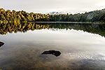
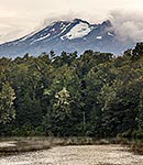
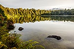
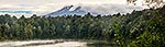
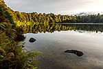
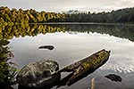
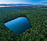
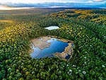
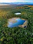
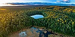
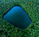
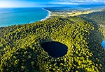
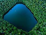
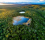
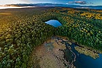
Lake Rotokura Ecological Reserve and beech forest, tapu, or sacred, to Ngati Rangi, on the flanks of Mt Ruapehu. Lake Rotokura and Dry Lake. Aerial view at sunset, Rangataua, Ruapehu District, Manawatu-Wanganui Region, New Zealand (NZ), stock photo.
These images are protected by copyright, but we license them to suit your needs. Click
'quick quote' to learn more...
Lake Rotokura Ecological Reserve and beech forest, tapu, or sacred, to Ngati Rangi, on the flanks of Mt Ruapehu. Lake Rotokura and Dry Lake. Aerial view at sunset, Rangataua, Ruapehu District, Manawatu-Wanganui Region, New Zealand (NZ) Stock Photo
Lake Rotokura Ecological Reserve and beech forest, tapu, or sacred, to Ngati Rangi, on the flanks of Mt Ruapehu. Lake Rotokura and Dry Lake. Aerial view at sunset, Rangataua, Ruapehu District, Manawatu-Wanganui Region, New Zealand (NZ)
 stock photo.")


")